Staying updated on weather developments, especially lightning threats, is critical for outdoor safety and operations. That’s why we’re excited to announce two new features based on user feedback for our industry-favorite Sferic Maps® software: the Lightning Alert Countdown Clock and Location Display Control.
Keep people safe from lightning with the countdown clock
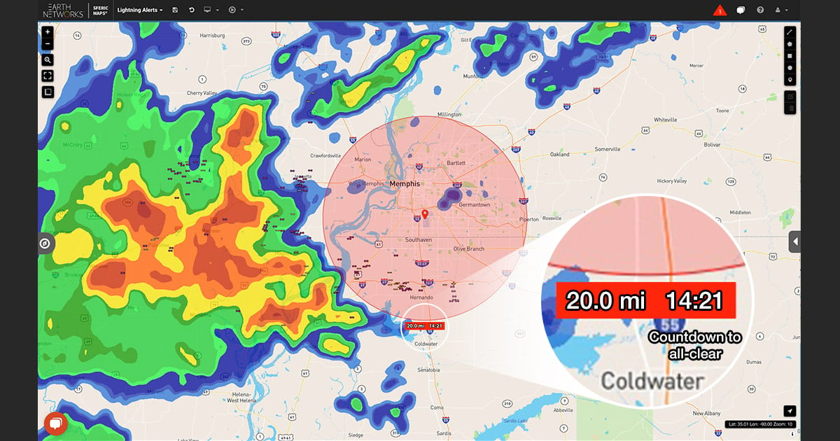
The new Countdown Clock makes operational decision-making with Sferic Maps even easier than before. A countdown automatically activates during a lightning alert and remains on screen to indicate the time remaining until it's safe for people to resume outdoor activities.
This feature streamlines translating policy into action, eliminating guesswork around safety to minimize risks. Configured via the Manage Rules tab, the countdown timer resets with each new lightning strike detected within the set parameters, so it’s always counting down from the most recent event for maximum clarity during long storms.
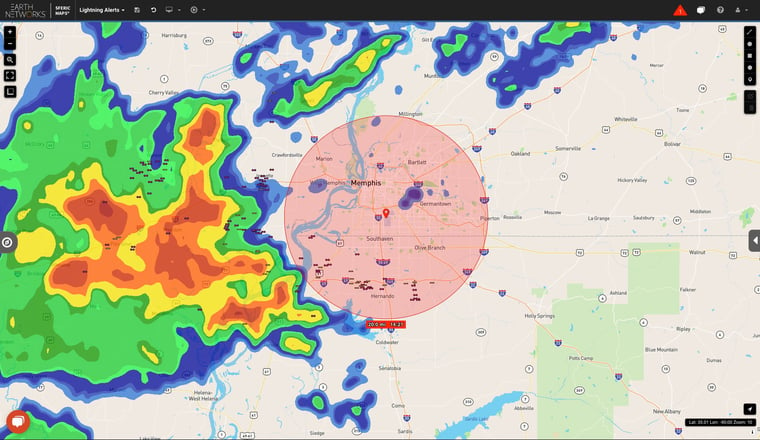
If you enable the Lightning Alert Rings feature under the Map Layer tab, you'll see your all your rule radiuses visualized as circles within Sferic Maps. Each circle is color coded:
- All Clear: When there's no threat, your rule radius is represented as a green circle.
- Under Alert: When a lightning threat is detected, your rule radius circle will turn red. Your countdown will be displayed in the label box directly below the circle.
These visual aids mean you can monitor lightning threats across multiple locations simultaneously, knowing precisely when it's safe to resume operations at each one.
Making local lightning alerts clearer with Location Display Control
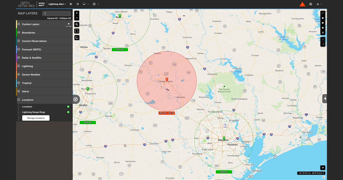
Monitoring multiple locations comes with its own set of challenges -- chiefly, maintaining focus where it's needed most. Our new Location Display Control mitigates this by allowing you to display or hide locations on the map based on their alert status.
This feature is crucial in eliminating unnecessary clutter from your map, enabling a focused approach to monitoring. You have three configurations for each location:
- Always: Locations are always shown.
- When Under Alert: Only display locations currently under a lightning alert.
- Never: Locations are never displayed.
The example below shows a Sferic Maps user monitoring a variety of campuses in Texas, with four alerting radiuses in close proximity to each other. The new location display control feature within Sferic provides that user the flexibility to see only campuses that are under alert for maximum clarity.
Understanding lightning risk in Sferic Maps just got easier
So, what do these features mean for longtime Sferic Maps users or folks who’ve been on the fence about Sferic for a while? They mean risk monitoring just got more focused and user-friendly.
Imagine overseeing an event with multiple sites under your watch. With traditional systems, tracking the movement of a weather system across a large geographic territory is downright overwhelming, especially when you have to consider how the event plays out differently in each individual place of interest. However, with Sferic Maps' new features, you can…
- Limit your focus to locations where lightning is an active threat, eliminating the need to sift through irrelevant data
- Use the reliable Countdown Clock, which indicates when each specific site is clear of danger from lightning
Ready to make Sferic Maps part of your weather risk toolkit?
Thanks to these enhancements, Sferic Maps is now an even better tool for lightning risk monitoring and detection. In addition to visualizing lightning around the world, the software is continuing to evolve as an operational leadership and decision support engine.
At AEM, our purpose is to empower communities and organizations to survive – and thrive – in the face of escalating environmental risks. Continually strengthening our software offerings based on user feedback is a key part of that mission. That’s why we’re excited to release these new features and look forward to hearing about how the functionality is making a difference from real users.
If you’re not already using Sferic Maps, this is a great time to get started with the industry’s most powerful lightning software, powered by the most precise total lightning network on earth.