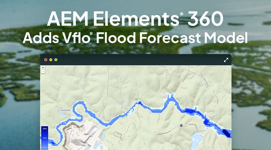
When a major storm approaches, you don’t just need a weather forecast; you need a flood forecast. Without it, you know something scary is heading your way, but you’re guessing at what it’s going to do. That’s why we’ve integrated the Vflo® Flood Forecast Model into our flagship AEM Elements® 360 application. Now, floodplain administrators, emergency leaders, and water management professionals can get a high-accuracy view of a flood before it happens.
Moving forward, we’ll…
- Introduce Vflo and describe what makes it so useful
- Provide a demonstration of Vflo in AEM Elements 360
- Share how Vflo is already increasing flood resilience in Raleigh, North Carolina
What is Vflo?
Vflo creates a hydrological model of your specific area that tells you exactly where water is going to go during a storm. That enables you to visualize the entire flood risk management cycle:
- Before a major storm, Vflo can run high-accuracy simulations to predict where flooding is likely to occur (both generally and based on forecasts for specific weather systems).
- During a major storm, Vflo helps provide a real-time picture of how the event is unfolding, even in areas between rain gauges and monitoring stations.
- After a major storm, Vflo shows you where to target recovery work and helps you assess your response during the event.
Vflo modeling provides a foundation of location-specific risk knowledge that aids in the development of impactful Flood Early Warning Systems (FEWS). The model helps you understand high-priority areas for infrastructure improvements or additional monitoring stations to increase decision-making intelligence. Furthermore, it enables high-accuracy forecasts that you can use as a reliable basis for flood alerts, evacuation orders, and beyond.
How does it work?
In a nutshell, Vflo gets to know your area and all its unique topography – the infrastructure, the waterways, the flood-prone flash-y spots, and beyond. Then, it takes in precipitation data and models out both where that water will land and where it will wind up.
The Vflo model breaks your area into a grid to analyze water behavior at a granular level. Each square of the grid is like a mini-model, rapidly calculating rainfall, pooling, and both surface and subsurface runoff for that precise area. Vflo then automatically maps out the interactions between squares to create a big-picture model of the entire region. That enables high-accuracy inundation mapping so you can see exactly where a flood will occur and how much water will be in the area.
That process involves many complex equations, but the great thing about Vflo is it does all that for you. You can think less about math and more about action – and it’s much easier to help less engineering-minded colleagues understand the situation at a glance to accelerate coordination.
In the past, flood forecasting was difficult for most places because rain gauge networks simply weren’t dense enough to provide the model with enough data. Vflo eliminates that challenge by using Gauge-Adjusted Radar Rainfall (GARR) data, which feeds the model with high-accuracy information about rainfall accumulations and rates across the area, including areas traditional gauges don’t account for. Depending on the situation, you might feed the model forecast data (to prepare for a storm), real-time data (to understand the storm as it unfolds), or historic data (to simulate a past event).
Ready to see the Vflo Flood Forecast Model in action?
Vflo is a highly visual tool, so rather than describing it using any more words, let’s take a look at how Vflo modeling and GARR precipitation data come together to forecast flood impacts and improve overall resilience:
Vflo case study: Raleigh, North Carolina
Raleigh, North Carolina, is a city of just under a half-million people with a growing flooding problem. They had plenty of weather and water monitoring equipment in the field, but they struggled to turn the data from those devices into a cohesive narrative in time to take action.
The true scope of the situation became clear in 2018, when the city experienced over three inches of rain in a single hour, flooding roadways and culverts in some areas. The situation was completely unpredicted, and the city staff didn’t even know the flood had happened until the storm was over.
That moment was a major catalyst, and recognized they needed to shift from a reactive flood management strategy to a proactive one.
Now, with Vflo modeling, Raleigh has significantly improved situational awareness before, during, and after storms. They now have 72 hours of advanced notice for any potential flood event, which has enabled them to communicate with citizens much more effectively about flood risk and pre-stage assets near where they’ll be needed but not close enough that they’re in harm’s way.
“We felt that the [Vflo] model…worked better than other proposals for urban areas and the flashy flood situations that we have. I think we made a wise choice because the watch points that we have in our system, it’s amazing how accurate they are…on the timing and the height.”
— Kelly Daniel
Flood Early Warning System Engineer & Project Manager,
City of Raleigh, NC
Manage water, rain, or floodplain? Be in the know with Vflo!
If you’re in floodplain or emergency management, Vflo flood forecast modeling can provide you with a deeper understanding of hydrology and severe weather in your area so you can focus on leadership and keeping people safe. Accurate modeling eliminates risk awareness gaps, and reliable rainfall forecasts tell you exactly what you need to prepare for and how you need to respond.
Ready to learn more about what the Vflo modeling process looks like or how GARR can rapidly increase your flood forecasting capabilities? It’s time to sit down with a hydrometeorologist from AEM and uncover your path to true flood readiness.


