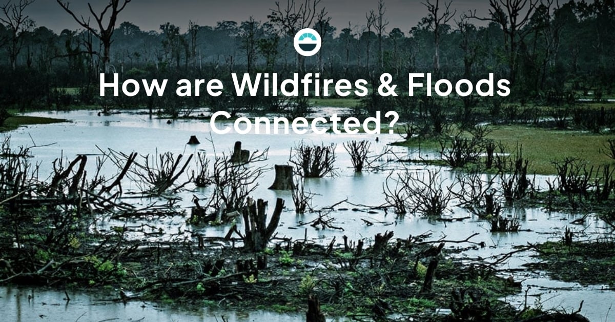
Wildfires and floods are both on the rise across the United States and globe, and that's not a coincidence. Some of the most destructive and costly new flash floods are either the direct result of or seriously exacerbated by previous wildfire activity.
Moving forward, we'll explore...- How wildfires make affected areas more flood-prone
- Why floods in wildfire-ravaged areas are especially destructive
- How communities can prepare better for the risk of post-wildfire floods
The connection between wildfires and floods
Did you know that an area affected by a wildfire will be increasingly flood-prone for up to five years?
That's because the destruction of a wildfire doesn't end when the blaze is extinguished. Fires denude the land of vegetation, which is sad to look at but also robs the ecosystem of its natural resilience by killing trees and plants whose roots hold the area's soil in place.
Hot ash and charcoal from the fire also create a barrier layer that sits on top of, and ultimately mixes with, the natural topsoil. That barrier prevents the ground from absorbing rainwater correctly, instead creating a thick, runny mud layer on the surface.
Due to both of those factors, when strong storms dump rain onto the region, the natural drainage of the wildlands fails, and the excess water and mud (as well as any remaining fire debris caught in the mix) seek places to pool or run off, providing what some meteorologists call a "steroid injection" to a potential flash flood.
In short, that's how wildfires cause (or exacerbate) flooding.
Why are the floods that follow wildfires so destructive?
As we mentioned above, a flood that follows a wildfire isn't just water. There's often dense, fast-moving mud, pieces of huge trees, and any manmade objects that had to be abandoned before the blaze reached the area (imagine logging or mining equipment, for example, or pieces of damaged utility infrastructure). The more recent the original fire, the worse the threat.
All those added factors make floods after wildfires especially destructive to property and infrastructure in their path and especially deadly for any people. The presence of debris and mud significantly increases the economic impact of a flood as well, doing more potential damage to roads, homes, and so on and requiring more expensive and elaborate clean-up, both for individuals and municipalities.
How can communities protect themselves from after-wildfire floods?
There's absolutely nothing any individuals, businesses, or government agencies can do to ensure a wildfire never ignites or a flood never happens -- both are naturally processes, to a degree. With that said, let's take a moment to look at each of the two big pieces of the puzzle: reducing the impact of the fire and anticipating a potential flood to allow the community to prepare, protect their property, or evacuate as needed.
Reducing the impact of fires
The best way to minimize the potential impact of after-fire floods is to limit the impact of any given fire through early detection and effective collaboration between land management and firefighting agencies.

Early detection involves comprehensive monitoring, both of visual conditions and weather data in high-risk wildfire zones. By watching the weather, understanding where lightning is striking, and keeping an automated camera eye on their most critical locations, forestry agencies and fire districts can understand where it's possible or likely a wildfire might start or has ignited, enabling a prompt mitigation response.
Executing great collaboration requires a shared understanding of weather and fire data and straightforward, actionable communication. Increasingly, agencies who need to collaborate to fight wildfires are using digital platforms that allow automation to create the visibility they need to work together in the most rapid, effective fashion.
Proactive flood monitoring
The other key to limiting the damaging potential of post-wildfire floods is maximizing awareness of when and where floods could develop and how they could impact people, property, and infrastructure.
In order to do that, local governments, utilities, and other public safety stakeholders need a high-accuracy forecast that blends general weather information with hyperlocal data gathered from sensors and stations in their region or area to create a forecast that's specifically focused on that team's situational awareness. That information will be much more reliable than any standard forecast and will help fire responders, emergency response coordinators, and other safety professionals understand when the community needs to be worried about a potential flood-producing storm.
As that storm approaches, leaders need to make important decisions based on how the situation is developing in the area. Again, a local sensor network and team of meteorologists are the most effective tools for understanding exactly where waters are rising in order to make the most informed possible decisions about evacuations, road closures, and beyond.

Once flood conditions are detected, public safety response becomes the main concern. The same data and tools that help leaders understand when a flood is approaching will inform the response during the event as well as your path to recovery.
Talk to a wildfire & flood solutions expert
Trying to build a deeper understanding of how our growing severe weather threats are interconnected? Looking to get your hands on the best emerging tools for wildfire and flood detection? Want to get more specifics about how meteorologists, fire safety professionals, and land management agencies can make the most of their collaboration?
If you answered "yes" to any of the questions above, it's time for a one-on-one chat with an AEM solutions expert who can help you understand your challenges better and begin your journey to building a solution! Contact us today.


