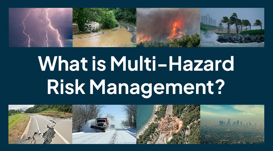
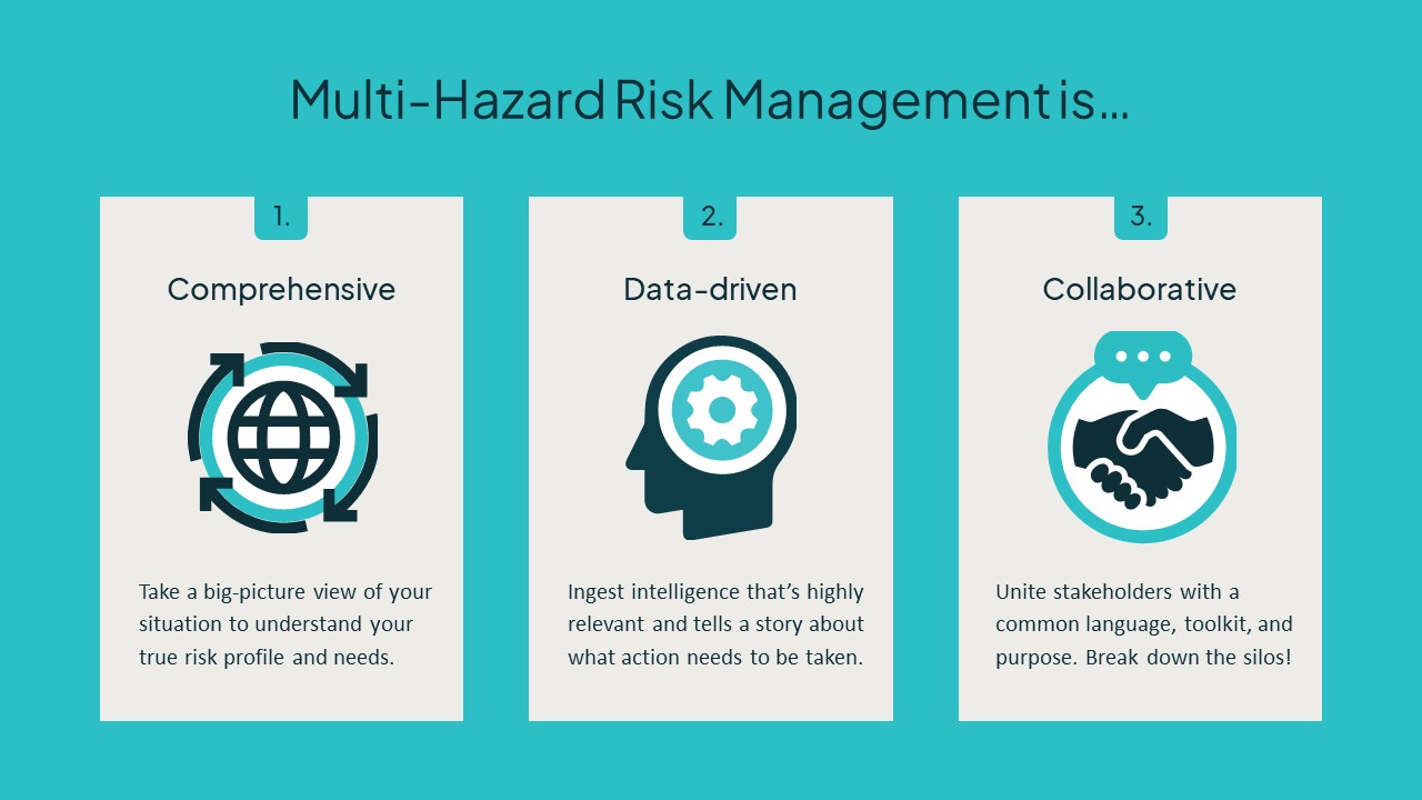
Multi-hazard risk management is the practice of having a single consistent approach to natural hazard monitoring, detection, and response collaboration that can be employed in the face of whatever Mother Nature throws your way. The multi-hazard approach encourages a big-picture focus on how businesses and communities can anticipate risks and work together to turn data into action when it counts most.
Moving forward we’ll explore…
- Why multi-hazard risk management is especially relevant and powerful today
- The fundamentals of multi-hazard environmental risk management
- The tools businesses need to bring multi-hazard risk management to life
Why is multi-risk hazard management growing in relevance?
Major environmental risks are growing in frequency, scope, and economic impact.
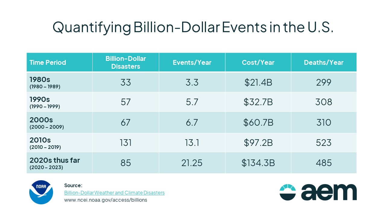
The NOAA National Centers for Environmental Information’s ongoing study of billion-dollar events illustrates a troubling trend here in the U.S. To qualify as a “billion-dollar event,” a drought, flood, freeze, storm, cyclone, or other climate disaster must exceed $1 billion in overall damages/costs (adjusting for inflation).
From 1980 to 2009, there were 5.2 billion-dollar events on average per year. From 2010 to 2019, that number more than doubled to 13.1 billion-dollar events. If that jump isn’t impressive enough, the first four years of the 2020s have averaged over 21 billion-dollar events annually.
It’s not just the frequency of major disasters that’s giving community leaders pause; these events are harder to prepare for than ever before – and it’s not just an American problem. Weather and climate are increasingly variable around the world, and as a result, many areas are finding their environmental risk profile has changed.
For example, areas where snowfall is turning to rain are experiencing unseasonable thaws and freezes with the potential to cause floods, avalanches, landslides, and chaos on public roadways. Many places in the Mediterranean, China, and South America that previously identified as having a temperate climate are becoming increasingly arid, making wildfires and flash floods both more common and more dangerous in communities where they were not major concerns historically.
In this environment, government agencies and private businesses everywhere are beginning to shift away from their traditional response and resilience strategies that were siloed by event and looking for ways to grapple with the growing risk of weather and environmental events in a thematic, consistent manner where they can trust they’re ready for anything.
That’s why the WMO teamed with the United Nations Office for Disaster Risk Reduction (UNDRR) to launch the Early Warnings for All initiative in 2023 with the goal of protecting every single person around the world from hazardous water, weather, and climate events with multi-hazard early warning systems by the end of 2027.
Unfortunately, the pace of multi-hazard management adoption is not matching the pace of growing natural hazards, particularly in the developing world. UNDRR’s December 2023 report on the current state of early warning systems found that just 45% of countries in Africa and 37% of countries in the Americas and Caribbean have a multi-hazard early warning system.
While the Arab States (55% coverage), Europe (55% coverage), and Asia-Pacific region (67% coverage) have all experienced significant growth in the area of multi-hazard risk management capabilities over the last decade, the least developed nations in the world and small island nations – some of the places most at risk from major environmental, weather, and climate events – are severely lagging behind.
What does multi-hazard risk management “look like”?
On a quiet day, great multi-hazard management might look downright passive, but it’s actually incredibly powerful. Community leaders and operations leaders across many industries ingest high-accuracy forecasts for their pinpoint locations to guide day-to-day decisions about asset allocation and prioritization of work, while their engineering colleagues monitor an environmental sensor network that provides real-time insight into local conditions and potential risks. In this way, a community can build daily resilience to an increasingly variable environment, become more efficient, and foster a culture of climate readiness.
When a major natural hazard event does develop, however, that same approach that provides daily strategic insights seamlessly transitions into a framework for difference-making intelligence, communication, and collaboration. Real-time conditions and precision forecasting form a straightforward common language that stakeholders across a variety of agencies and organizations can rely on as a shared source of truth to inform planning and response before, during, and after any given event.
Multi-hazard risk management in action: maximizing event response
To provide an example, consider the case of a severe storm with heavy rain. Forecasting can help track the weather system as it approaches, determine its most likely path through a community, and identify hyperlocal areas of especially high risk. That intelligence can immediately be used to assign public works and emergency management professionals to high-risk areas to cut branches, clear gutters, place sandbags, and perform other work to prepare.
As the storm enters the area, water management and floodplain engineers who monitor the area’s sensor network will immediately be able to visualize the impact in real time, providing data and expertise they can share with emergency responders and event managers to provide an up-to-the-minute understanding of how the storm is playing out and which areas are most affected. That might also trigger police to close key strategic intersections, sidewalks, and other high-traffic areas to protect people from potential flooding.
While the event plays out, local stormwater management leaders can continue to track sensor network observations and monitor the progress of the storm to assess risk to infrastructure and make informed decisions about how to manage the flow through local sewers, dams, and so on. At the same time, local fire service and forestry professionals track area lightning strikes so they can anticipate potential fire ignitions and improve their chances of containment, both in the community and in the wilderness.
When the storm passes, multi-hazard risk management keeps on going. Their pinpoint forecasts and local monitoring network will continue to tell response professionals and engineers where attention is required most to aid in drainage, divert motorists away from dangerous areas, and repair damage to local infrastructure.
In that example, a clear comprehensive approach was used to address the following potential hazards and risks:
- Flooding: Local leaders knew the storm was coming because of the forecast. They were able to prepare proactively and monitor the situation as it evolved for maximum intelligence on asset allocation. As the storm played out, stormwater leaders could visualize flooding as it occurred to ensure their infrastructure was working and identify opportunities to accelerate the recovery.
- Road weather hazards: By monitoring water levels around key intersections and low-lying roadways, the community was able to close and reopen roads in a responsive way that kept people safe and prevented further distractions for emergency responders during the event.
- Damage to infrastructure: Armed with the right data, wastewater and stormwater leaders had a full-picture view of how the storm was playing out, allowing them to make smart decisions around sewer and dam controls that prevented further flooding or harm to the system.
- Wildfire: Lightning intelligence throughout the storm provided forestry and fire service leaders with the information they needed to detect possible fire ignitions and send assessment/mitigation teams as quickly as possible to contain as necessary.
- Mudslides: Insights on rainfall and soil moisture at key high-risk areas helped local responders identify roadways for closure and detect where mudslides were mostly likely to have occurred during the storm, accelerating clean-up and recovery.
This example illustrates the true power of multi-hazard resiliency. Had the community just focused on responding to the evident flooding in the roadways, they might’ve missed a wildfire ignition or left people at risk of being injured in a mudslide. By taking a big-picture collaborative approach powered by reliable data, a large team of stakeholders in a variety of roles stepped up to protect their community from every conceivable angle. That’s what’s required in this new era of billion-dollar events.
How to adopt multi-hazard risk management
The goal of multi-hazard risk management is to provide a cross-applicable playbook and toolkit that enables community stakeholders to come together to minimize the economic and human impact of weather, climate, and environmental events. That requires a strong foundation of self-knowledge, a high-level understanding of emerging best practices, and a dedication to doing whatever it takes to deliver for the community.
If you’ve got the desire to make a difference in the face of increasing weather challenges and environmental risks, AEM can help you roll out a multi-hazard risk management practice that will transform your community in terms of climate resilience and emergency response coordination. To learn how you can take your first steps toward multi-hazard readiness, schedule your resiliency assessment today!