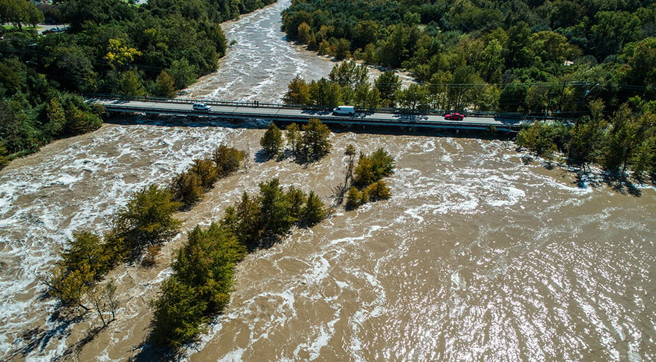
Rising sea levels and changing precipitation patterns are exposing many areas to heightened flood risks. At the same time, other areas are being left dry, waiting for rain to replenish dwindling surface water supplies. The ability to accurately monitor and predict hydrometeorological conditions is becoming increasingly vital for safeguarding communities and managing water resources. Our latest blog post will introduce you to the fundamentals of hydromet monitoring while delving into emerging practices and innovations.
Here's what you'll discover:

Hydrometeorology defined
Hydrometeorology (often abbreviated as hydromet) is a discipline that lies at the intersection of hydrology and meteorology.
Meteorology studies atmospheric processes and phenomena to better understand and predict the weather and climate of a region. Hydrology, on the other hand, is the study of how water moves and is distributed on and below the Earth’s surface.
One of the main focal points of hydrometeorology is the hydrologic cycle (also known as the water cycle). Water continuously moves between the Earth and atmosphere through a complex set of processes that include evaporation, transpiration, condensation, and precipitation. The overall cycle that encompasses these processes is known as the hydrologic cycle.

A common hydromet priority is studying relationships between meteorological variables and the amount of rain reaching the ground. Hydrometeorologists also study the relationships between the amount of rain reaching the ground and its impact on surface water levels. These and other analyses are used in the design of flood management and water usage structures, such as dams and reservoirs.
What is a hydromet monitoring system?
At the most fundamental level, a hydromet monitoring system consists of the infrastructure needed to monitor key hydrometeorological variables. The choice of which variables to track will ultimately depend on the intended use of the system. They could include any or all of the following:
- water levels in rivers, lakes, reservoirs, etc.
- water discharge rates and velocities
- the amount of rain reaching the ground at key locations
- tidal changes
- wind speed
- wind direction
- soil moisture
- water turbidity
- etc.
The main uses of most hydrometeorological monitoring systems fall into two broad categories:
- Flood early warning: Using a hydromet system to identify real-time flooding or anticipate when and where flooding is likely. The objective is to mitigate losses of life and property.
- Water supply management: Using a hydromet system to provide information relevant to maintaining an adequate supply of water for consumption, other household and industrial uses, hydroelectric production, and/or agricultural benefits.
To serve these functions, most hydromet systems are comprised of three main types of components:
- Sensors to measure key hydrometeorological variables.
- Telemetry to relay data from the sensors to other locations.
- Software to (a) collect, analyze, and visualize data while (b) alerting stakeholders to relevant changes in hydrometeorological conditions.
.png?width=600&height=300&name=Hydromet_1200x600_2%20(1).png)
The basics of hydromet system architecture
The process of developing a hydrometeorological monitoring system comes down to three key phases:
- Discovery: The purpose of this phase is to uncover challenges, requirements, limitations, etc. that will eventually guide the decision-making process during the Design phase.
- Design: The Design phase involves selecting the right combination of monitoring sites, hardware, and software to meet the specific needs of the system’s stakeholders.
- Implementation: This involves building the monitoring sites, installing the sensors, configuring the hardware and software that make up the system, and setting up arrangements for ongoing maintenance.
To ensure that the system achieves its objectives consistently and reliably, the entire development process needs to be guided by a framework of five key principles or pillars. (Note that our recommended framework is an evolution of the four pillars of multi-hazard early warning systems, as articulated through the United Nations Early Warnings for All initiative).
- The system should support and be grounded in a clear understanding and assessment of targeted hydrometeorological risks (e.g., flood risk, drought risk, water quality risk, etc.).
- It should monitor and forecast relevant hydrometeorological conditions.
- It should communicate relevant hydromet information to stakeholders, such as agencies and the public.
- The system should guide response to hydromet hazards (e.g., emergency response to flood events) through information and alerting.
- And it should provide feedback to support ongoing evaluation and improvement of the monitoring system.

Although the fundamentals of hydromet system architecture are fairly logical and relatively straightforward, the process of applying these principles to real-life situations requires deep expertise. For many organizations, it may make the most sense to enlist the help of outside experts like AEM’s Professional Services team.
Regardless of whether you plan to manage the development process yourself or tap into external expertise, you’ll want to take a deeper dive into each of the basics. To that end, I highly recommend checking out our webinars on flood risk knowledge and flood monitoring and forecasting. We’ve also published some excellent blog posts on selecting the best sensors for monitoring water levels and water discharge rates.
Beyond fundamentals: Trends in hydromet system development
Beyond the fundamentals, there are a number of trending issues that are actively shaping current approaches to hydromet system development. Here are some of the biggest trends that we continue to hear about:
Leveraging AI to predict hydrometeorological threats
Some hydromet systems have turned to AI to assist with anticipating threats like flooding. This makes sense, as AI offers some important strengths. AI is incredibly good at pattern recognition, and it can go a long way toward automating the identification of flood threats.
But it also has a critical limitation. Its output is only as good as its input. If the data being fed into the AI is incomplete, inaccurate, or otherwise not fully representative of an area’s hydrometeorological conditions, then it can deliver misleading results that lead to bad decisions during a critical time. If the AI makes a mistake that goes undetected, it can lead to costly miscalculations in the deployment of resources, even to the loss of lives and property.
The best uses of AI incorporate it along with detailed modeling of local hydrological conditions and a variety of other data sources, including rain gauges, water level sensors, etc. The sensor data and localized modeling can help with (1) corroborating what the AI is saying and (2) teaching the AI about an area’s unique hydromet conditions, so it can become more accurate.
Recognizing the need for holistic, integrated software solutions
Historically, most software solutions in the environmental monitoring space have focused on solving highly specific challenges. While there is certainly a place for the occasional stand-alone specialty solution, their dominant place has left flood plain managers, emergency managers, public works professionals with fragmented data spread across too many different applications. So, when a hydrological emergency hits, they often have to waste time and/or limited resources piecing together all the different information sources before they can figure out how to respond to what is happening.
Leaders in the hydromet monitoring space are now recognizing the need for a holistic, integrated software solution that can incorporate data about environmental risks from a wide variety of sources into a single, coherent view of the situation. So, individual stakeholders can achieve improved situational awareness and faster response. And, they are in a better position to collaborate effectively with other agencies and organizations.
Reliance on internet connectivity for network communication
We’ve also seen a trend toward leveraging internet connectivity to relay vital data from hydrometeorological sensors (aka the Internet of Things or IoT). Internet connectivity offers several advantages. It leverages existing infrastructure and offers real-time communication that can potentially reach the vast majority of the population.
Unfortunately, except for large metropolitan areas that benefit from dedicated emergency channels and cellular hardening, cellular generally lacks the high reliability of other telemetry options. We’ve all heard of internet and cellular service going out during damaging storms. Yet, those are the times when timely communication is likely to be most crucial for saving lives and property.
The best uses of internet connectivity combine it with other forms of telemetry to create redundancy. This allows the hydromet system to benefit from the strengths of IoT without giving up reliability. This could involve implementing a secondary form of telemetry in addition to cellular. Or, it could involve adding cellular capabilities to other networks, such as VHF repeaters, to transfer data to the cloud, even if a receiving tower goes down.
Increasing use of contactless sensors
The most widely used water sensors have historically operated through contact with the water. Although we won’t go through all the sensor types here, there are far fewer types that do not require contact with the water. Radar-based sensors are among the few that do not.
Although radar sensors have a higher up-front cost than some other options and usually require a mounting structure, their adoption is growing. Their main advantages are that they don’t require contact with the water, and they are far less likely to be damaged or disturbed. They are also immune to changes in air temperature and atmospheric pressure. All these factors improve accuracy and reliability while reducing maintenance costs in the long term. In fact, with proper installation, radar can be virtually maintenance-free.
Growing adoption of Gauge-Adjusted Radar Rainfall (GARR)
Precipitation is the number one atmospheric input into most hydrological systems. Without an accurate picture of precipitation, it can be difficult to anticipate and deal with these influxes into the watershed.
Historically, there have been two main options for measuring rainfall:
- Rain gauges provide extremely accurate measurements of rainfall at specific points in space over specific time periods. However, even the best networks leave massive gaps between gauges and large amounts of guesswork for determining total rainfall in an area.
- The other option is radar, which does an outstanding job of showing variations in rain across an area, but it falls short of accurately determining the total volume of rainfall.
Gauge-Adjusted Radar Rainfall, or GARR, combines the spatial component of the radar data with accuracy of rain gauge data. By marrying rain gauge data to specific points in the radar’s field of view, we can leverage the variations shown on radar to accurately determine absolute rainfall values throughout an area. The growing adoption of GARR across hydromet monitoring systems indicates a widespread need for more robust and accurate rainfall datasets to drive decision-making.
Postcript: The practical importance of hydromet monitoring
The reliability and effectiveness of hydrometeorological monitoring systems are not just academic concerns – they are essential to protecting lives, livelihoods, and property. While it’s important to be educated about the architecture and purpose of these systems, all of that knowledge is worthless if it isn’t being applied back to your own, real-life needs.
I would encourage you to consider how your own system stacks up against what you’ve learned. Does it have the components you need? Does it have the right components to meet your needs? How are you even deciding what counts as success? Have you looked at its performance through the lens of a well-defined framework?
To help you get started, we’ve developed a 90-second self-assessment that will give you a baseline understanding of how your system currently stacks up. Once you have a clear view of your current situation, you can begin to formulate a plan that gets you to where you need to go.
